Delivery Logistics
7 Best Apps for Delivery Dispatchers
Top 7 truck dispatch apps for 2024: Find the best solutions for real-time tracking, route optimization, and efficient fleet management.
Explore specialized truck navigation apps for efficient routing, live tracking, and truck-specific features. Ideal for professional trucking needs.
In trucking and delivery logistics, having a reliable navigation app is crucial. These apps give directions and important info about safe routes for big trucks.
They help drivers avoid problems like low bridges and weight limits, making deliveries smoother and faster.
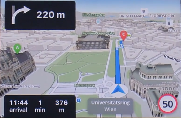
Out of the many navigation tools out there, Google Maps is a favorite for its easy-to-use design and availability. It's great for general navigation with lots of helpful features.
But when it comes to trucking, there are special things to think about. This article looks into whether Google Maps is good enough for truck drivers or if tools like eLogii, made just for them, might be better.

Truck driving is different from regular commuting, especially when it comes to finding the right routes. Understanding these special needs is key to figuring out if navigation apps like Google Maps work well for truckers.
For truckers, planning routes is super important. Trucks can't go just anywhere because of their size and weight.
So, a good navigation app for trucks has to know about specific rules, like height and weight limits, and show routes that are okay for big vehicles. Ignoring these rules can cause big problems with deliveries and even legal troubles.
Another important thing is getting updates on traffic in real time. Truckers and dispatchers usually have tight schedules, so they need to know if there are any traffic jams, accidents, or roadwork that could slow them down. Being able to change routes quickly is important for truckers.
Also, knowing about road closures is a big deal. If a road is closed, it can mess up a truck's plans more than it would for a regular car. Finding another way that works for a big truck can be tricky.
And lastly, knowing about toll roads is key. To plan the cheapest route, truck drivers and their managers need to know where toll roads are and how much they cost.
.jpg?width=700&height=467&name=pexels-fausto-hernandez-196511575-12276484%20(2).jpg)
Google Maps is well-known for being easy to use and having lots of info. But when it comes to truck navigation, we need to check if it works well for trucks.
Google Maps is great for planning routes for regular cars, with live traffic updates and options to change routes. But it's not specialized for big trucks like some other apps.
It doesn't offer truck-specific guidance, like avoiding roads with weight limits or low bridges, which truckers need.
When you compare Google Maps to apps made just for trucks, it doesn't stack up as well. Specialized truck navigation apps are made with truckers in mind. They have features like making routes specific to a truck's size and weight, warning about roads that trucks can't go on, and showing where truck parking is available.
These apps also give a lot of info about toll roads that are just for trucks, so drivers can plan their costs better.
Google Maps shines with its live traffic updates, providing instant details on traffic jams, accidents, and road shutdowns. This real-time data is crucial for planning routes and dodging hold-ups.
Although Google Maps is strong for regular navigation, its absence of features tailored to trucks makes it less fitting for truck drivers compared to specialized truck GPS apps. Truckers might use Google Maps for quick checks, but for thorough route planning and navigation, dedicated truck GPS apps are better suited.
Google Maps, although widely used for navigation, doesn't cater to truck drivers' needs, creating hurdles for commercial vehicle travel.
A major issue is the lack of truck-specific route guidance. Unlike dedicated truck apps, Google Maps doesn't factor in truck height, weight, or length restrictions. This can lead truckers into trouble with low bridges or weight-restricted roads, causing legal and safety concerns.
Moreover, it's tough for truckers to find suitable parking spots for resting. Truck drivers, especially on lengthy trips, can face significant hassles due to this.
For commercial vehicles, navigating efficiently and safely means mapping out routes that work for big rigs and following transportation regulations. The difficulties of using Google Maps for this include:
While Google Maps excels in general navigation, its limitations in meeting the unique needs of truckers and commercial vehicles make it less than ideal for professional truck routing. Truck drivers might need to rely on extra resources or specialized apps to address these gaps for a more comprehensive navigation solution.
Although Google Maps is great for everyday navigation, truckers need more specialized tools. Several alternatives in the market focus specifically on truckers' needs. These offer features that tackle the unique challenges of truck navigation.
Apart from mobile apps, there are standalone GPS devices designed just for trucks. Companies like Garmin provide dedicated truck GPS units equipped with features customized for commercial vehicle drivers.
In the upcoming sections, we'll delve into mobile app choices for truck navigation and compare their features, ease of use, and performance.

eLogii emerges as a robust solution tailored explicitly to tackle the intricate requirements of delivery teams. It provides features that surpass Google Maps in various crucial aspects.
Features of eLogii:
Benefits over Google Maps:
In conclusion, eLogii presents a complete array of features tailored for delivery teams. That positions it as a superior option to Google Maps for businesses prioritizing delivery efficiency and customer satisfaction.

Waze stands out as a popular navigation app known for its innovative approach to travel and routing, utilizing a community-driven platform. While it shares similarities with Google Maps, Waze offers unique advantages and features.
Waze features:
Advantages over Google Maps:
Besides, it's crucial to recognize that, like Google Maps, Waze isn't tailored for truck navigation. It lacks truck-specific functionalities like alerts for height and weight restrictions, essential for truck drivers.
While Waze excels in general navigation and traffic avoidance, truck drivers may need to complement it with additional tools or apps to ensure comprehensive truck-specific navigation.

Trucker Path is an app exclusively crafted to meet the specialized requirements of truckers, providing a range of features tailored specifically for those in the trucking industry. This focus grants it a clear advantage over broader navigation tools such as Google Maps.
Features of Trucker Path:
Advantages over Google Maps:
Trucker Path provides a variety of features tailored specifically to meet the unique requirements of truck drivers, rendering it a more appropriate navigation and logistics solution for individuals in the trucking industry when compared to Google Maps.
Sygic is a GPS navigation app that provides a specialized version designed specifically for truck drivers, offering features customized for the requirements of navigating large vehicles. Its emphasis on commercial driving renders it an attractive alternative to Google Maps for truckers.
Features of Sygic:
Advantages over Google Maps:
Sygic offers a range of features specifically tailored for truck drivers. It makes it a more suitable choice for those requiring detailed, truck-specific navigation and route planning capabilities compared to the more general approach of Google Maps.
Efficient route planning and selecting the appropriate GPS app are essential for successful long-haul and commercial trucking.
Route planning plays a critical role. This is particularly true in long-haul trucking. It requires the identification of the most efficient routes while factoring in truck-specific limitations, fuel economy, delivery schedules, and adherence to regulations.
Optimal route planning not only results in time and cost savings but also minimizes vehicle wear, enhances safety, and increases driver satisfaction.
When picking a truck GPS app, consider:
Key factors for choosing a navigation app:
Selecting the right app means finding one that meets your needs for efficient and safe navigation, while also being easy to use and affordable.
Although Google Maps serves well for everyday navigation, its inadequacies in truck-specific routing, such as the absence of tailored route guidance and parking details, diminish its suitability for professional trucking.
For truckers, selecting the appropriate navigation tool is paramount for effective and safe routing. It should provide comprehensive route planning, live updates, and adherence to truck-specific regulations.
eLogii caters to the distinct requirements of truck routing, offering features like optimized route planning, live tracking, and delivery coordination. Its intuitive interface makes it a pragmatic option for both truck drivers and dispatchers.
Top 7 truck dispatch apps for 2024: Find the best solutions for real-time tracking, route optimization, and efficient fleet management.
Uncover the 7 best trucking software solutions for small companies. Streamline operations, reduce costs, and enhance customer satisfaction today!
Learn how to start a truck dispatching business and how eLogii’s tools streamline route planning, driver management, and delivery operations.
Be the first to know when new articles are released. eLogii has a market-leading blog and resources centre designed specifically to help business across countless distribution and field-services sub sectors worldwide to succeed with actionable content and tips.
